
We are the Flood safety District

On July 1st, 2024, the Urban Flood Safety and Water Quality District took over flood safety management along the Columbia River.

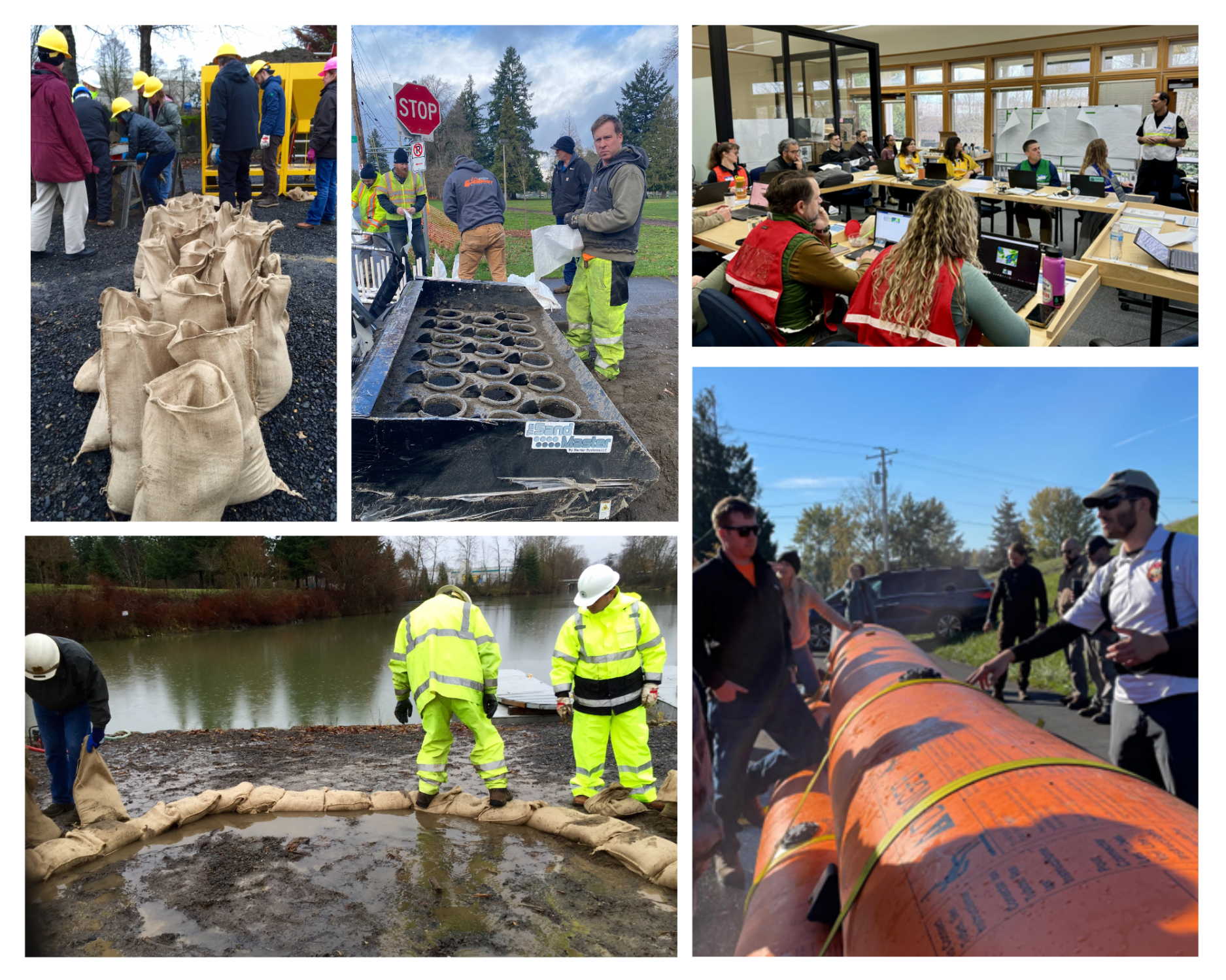
The Flood Safety District reduces flood risk for communities in Portland, Gresham, Fairview and Troutdale and supports the economic vitality of the Portland Metro region.

Square Miles Protected

Pump Stations

Miles of Levee

Residents

Miles of Sloughs, Canals, and Culverts

Jobs
About Us
The Urban Flood Safety and Water Quality District helps protect lives and properties from flooding by operating, maintaining and improving the flood safety system along the Columbia River in northern Multnomah County, and responding to flood emergencies.
On July 1st 2024, the Flood Safety District replaced four historic Drainage Districts that managed the flood safety system for over 100 years. This consolidation results in a more efficient governance structure and reflects the fact that the flood protection infrastructure functions as one complete system.
The UFSWQD takes a new integrated approach to flood safety, ensuring that flood safety solutions are equity-centered, resilient to climate change, nature-based, and culturally responsive. This integrated mission includes:
- Reducing the risk of flooding, protecting people and property from flooding, and responding to flood emergencies.
- Contributing to improved water quality, fish and wildlife habitat, and landscape resilience in the managed floodplain.
- Promoting equity and social justice in all aspects of the district’s operations.
- Preparing for and adapting to the impact of climate change in relation to the managed floodplain.
- Providing the public with information regarding the infrastructure and history of the managed floodplain.

What We Do

Levee Maintenance
| The Districts operate and maintain levees in compliance with federal standards to reduce flood risk for the areas behind the levees. This work includes vegetation management, levee inspections, and damage repair such as bank stabilization or replacement of rip rap (stone used to protect against erosion). |
Levee Maintenance

Water Conveyance
| To keep the land behind the levees dry, the Districts manage a complex series of sloughs, pipes, and culverts that feed into pump stations and move water away from the managed floodplain into the Columbia River and lower reaches of the Columbia Slough. This work involves monitoring and maintaining pump stations, clearing debris and other blockages from the conveyance system, and attending to wildlife activity when necessary. |
Water Conveyance

Emergency Preparedness & Response
| For those of us who live and work in the low-lying areas along the Columbia River, the local levees do a lot to reduce the risk of flooding. But no levee can ever provide 100% protection, which means it’s up to each of us to be prepared for a flood. A few hours spent making your home or place of business secure, preparing an emergency kit, and creating a flood plan can make a big difference. Here are some resources to help you prepare before a flood. |
Emergency Preparedness & Response

Support Regional Partnerships
| We recognize our position as a regional partner and often engage in service agreements with partners. Whether taking part in regional emergency response, reviewing development to determine flood risk impact, or providing our expertise to assist other public agencies, community organizations, or private landowners, the District aims to support efforts related to our mission. |
Support Regional Partnerships
Equity
| We live in a diverse community that is growing more diverse each day. To fulfill our core mission of flood safety, we are committed to investing in the diversity and cultural competency of our workforce and increasing the transparency and accessibility of our programs and projects. We’re also working hard to learn how best to address systemic inequities and to provide support and tools to our staff, board members, and community partners to help ensure equitable outcomes related to our work. |
Equity

Cultural History
| Coming Soon |
Cultural History

Climate Resiliency
| Coming Soon |
Climate Resiliency

Nature-Based Solutions
| Coming Soon |
Nature-Based Solutions
WHAT’S BEHIND THE LEVEES?
The flood safety system helps to protect 8,000 residents, 60,000 businesses, 2,000 acres of natural habitat, and critical services such as Portland International Airport and the region’s secondary supply of drinking water from being flooded by the Columbia River.

Nearly 8,000 residents

50% of the region’s manufacturing and warehouse jobs

2nd largest source of drinking water in Oregon

16M+ passengers annually at PDX

$16B in annual economic activity

2,000+ acres of open space and natural habitat
